Chilas
Chilas is a city and is the divisional capital of Diamer District located in Gilgit-Baltistan, Pakistan, on the Indus River. It is part of the Silk Road, connected by the Karakoram Highway and N-90 National Highway to Islamabad and Peshawar in the southwest, via Hazara and Malakand divisions of Khyber Pakhtunkhwa. To the north, Chilas connects to the cities of Tashkurgan and Kashgar in Xinjiang, via Gilgit, Aliabad, Sust, and the Khunjerab Pass.
Chilas comes under Gilgit-Baltistan. It is the headquarters of Diamir district. The weather is hot and dry in the summer and dry and cold in the winter. It can be reached by the Karakoram highway and also through the Kaghan valley and the Babusar Pass. Chilas is on the left bank of the Indus River. The beautiful Fairy Meadows National Park and Nanga Parbat, the ninth highest peak in the world, are also located in Chilas.
Karakoram International University recently opened a sub-campus in Chilas.
Even after Kashmiri-British rule was imposed a century ago, the Indus Valley west of Chilas was a hornet’s nest of tiny republics; there was one in almost every side valley, each loosely guided by a jirga (council of tribal elders) but effectively leaderless, all at war with one another and feuding internally. Though administratively lumped with Gilgit, Chilas and its neighbours are temperamentally more like Indus Kohistani people, probably due to a similarly hostile environment and the same Sunni Muslim orthodoxy. Their ancestors were converted to Islam by a Sufi Muslim, from the Kaghan valley. Syed Noor Shah, known as Ghazi Baba, was the first man to preach Islam in Thak, and built the first mosque, which is still there. Ghazi Baba belonged to the Syed family of Kaghan. In Tangir and Darel, Islam came from the direction of Swat direction. whereas hardly anyone north of Chilas in the Gilgit-Baltistan province is Sunni. Chilas Fort was first garrisoned to protect British supply lines over the Babusar Pass, and beefed up after local tribes nearly overran it in 1893. Now a police post, it has put a lid on Chilas, though not on the Darel and Tangir Valleys to the west. The Chilasis are Shina speakers, with some Pashtun settlers speaking Pashto. Urdu and some English are also spoken.
Map - Chilas
Map
Country - Pakistan
 |
 |
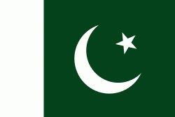
| Flag of Pakistan | |
Pakistan is the site of several ancient cultures, including the 8,500-year-old Neolithic site of Mehrgarh in Balochistan, the Indus Valley civilisation of the Bronze Age, the most extensive of the civilisations of the Afro-Eurasia, and the ancient Gandhara civilization. The region that comprises the modern state of Pakistan was the realm of multiple empires and dynasties, including the Achaemenid; briefly that of Alexander the Great; the Seleucid, the Maurya, the Kushan, the Gupta; the Umayyad Caliphate in its southern regions, the Hindu Shahis, the Ghaznavids, the Delhi Sultanate, the Mughals, the Durranis, the Omani Empire, the Sikh Empire, British East India Company rule, and most recently, the British Indian Empire from 1858 to 1947.
Currency / Language
| ISO | Currency | Symbol | Significant figures |
|---|---|---|---|
| PKR | Pakistani rupee | ₨ | 2 |
| ISO | Language |
|---|---|
| EN | English language |
| PA | Panjabi language |
| PS | Pashto language |
| SD | Sindhi language |
| UR | Urdu |


